

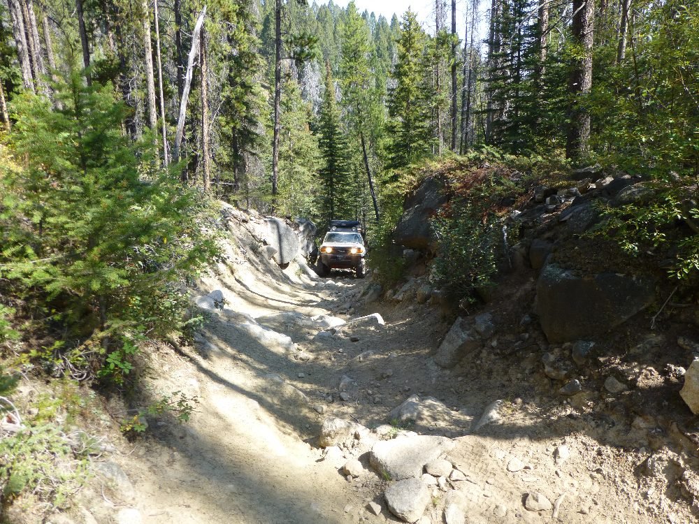
Little Boulder Road (FSR 86)
FSR 86 to the AGF Turnaround
From AGF's 2017 track start on Little Boulder Rd, about 0.5 mile to FSR 86 MP 2.45, where the Forest Service inventory begins FSR 86 (the county says the whole road is a county road: verify), then up the road to AGF's turnaround at track mile 8.6, and back: 17.2 miles round trip. FSR 86 continues about 1 more mile to MP 11.8; AGF did not drive it, and it is excluded. The county calls the upper end the Shiels and Ironside Mine area; the mine and pond at the turnaround are not identified in federal mine records: verify. The distance from Boulder to the track start was not measured: verify.
Difficult · Boulder Climb Before the Shiels and Ironside Mine Area
AGF rates a trail by its hardest unavoidable obstacle in normal dry conditions. Here that is the steep boulder climb before the Shiels and Ironside Mine area. The county's minimum for it is a modified rig with at least 33-inch tires and at least one locker. The county says: "A modified rig with min 33" tires and at least 1 locker should be able to make it with a competent driver. I've seen others do it with less, but they definitely had some body damage." The owner set the 6/10 on Oct. 14, 2026 for that climb. Below the climb the road is much easier: AGF's route is on the county's non-maintained section (the first 1.6 miles from Whitetail Rd, below AGF's track start, are chip seal), about 3/10 high-clearance, with a narrow loose-rock cut where wide vehicles can contact bodywork (AGF route research; onX, third party, rates the road 3). AGF drove this route on Aug. 26, 2017; the owner does not remember the climb. The Forest Service inventory lists FSR 86 at maintenance level 3, "Suitable for passenger cars"; that is a maintenance standard, not a condition report.
Terrain scores (rock, mud, water, exposure, snow, pinstriping) are not rated yet for this trail.
Snow, mud, runoff, deadfall and fire are condition changes, not part of the base rating.
Getting There
From Boulder, follow Little Boulder Rd (a Jefferson County road, which begins at the Whitetail Rd intersection) southwest up the Little Boulder River. AGF's 2017 track starts at 46.19826, -112.13098. In about 0.5 mile the road becomes FSR 86 (MP 2.45) and climbs west past the North Fork confluence (USGS gauge). Stay on FSR 86 to AGF's turnaround at track mile 8.6, turn around on the road, and return the same way.
The pin marks AGF's 2017 track start on Little Boulder Rd (AGF GPS), about 0.5 mile below where FSR 86 begins. It is not the turnaround. No downloadable track is published: the 2017 track has not been trimmed and renamed for publication.
Rig Requirements
- Stock 4x4
- Not advised past the boulder climb (county); below it, yes
- High clearance
- Required
- Tires
- 33-inch minimum for the climb (county)
- Rear locker
- At least one locker (county minimum for the climb)
- Front locker
- Not documented: verify
- Winch
- Not documented: verify
- Full-size
- Limited
- Body damage
- High risk on the climb with less than the county minimum (county)
Below the boulder climb, a stock high-clearance 4x4 on 31-inch-class A/T tires, with a full-size spare, rated recovery points and basic recovery gear, is enough (AGF route research); stock vehicles should turn around below the climb. For the climb, the county's minimum is a modified rig with at least 33-inch tires, at least one locker and a competent driver; with less, expect body damage (county). A spotter is useful in the tight upper cut. Wide or long-wheelbase rigs risk body contact. The 2023 MVUM copy lists FSR 86 as open to highway-legal vehicles, ATVs and motorcycles (county segment: verify); side-by-sides wider than 50 inches are not listed (2023 MVUM copy): verify. Confirm the class on the 2026 MVUM.
Know Before You Go
- Season
- Late spring through fall, snow permitting (AGF estimate); winter-range motorized closure, dates: verify
- Typical trip
- Half day (AGF estimate)
- Camping
- Limited (AGF research); not at the private turnaround
- Trailer parking
- Limited (AGF research)
- Turnaround
- On the road at the AGF turnaround; private land beside it
- Hunting season: Montana's general deer and elk season runs Oct. 24–Nov. 29, 2026 (FWP). Expect hunters, camps and parked vehicles; wear blaze orange outside the vehicle. Archery season runs to Oct. 18. A youth deer hunt runs Oct. 15–16 (FWP).
- Bear country: Beaverhead-Deerlodge food storage order 02-00-22-02 applies Mar. 1–Dec. 1.
- No Beaverhead-Deerlodge alert named Little Boulder, Boulder or Jefferson County on Oct. 14, 2026 (fire danger Moderate). Recheck before you go.
- Stay out of old mine openings, shafts and structures.
- Contacts: Butte Ranger District 406-494-2147; Jefferson County Road Department 406-225-4158; Beaverhead-Deerlodge Supervisor's Office 406-683-3900.
On the Trail
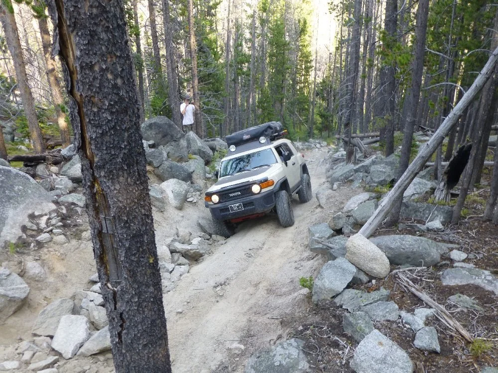
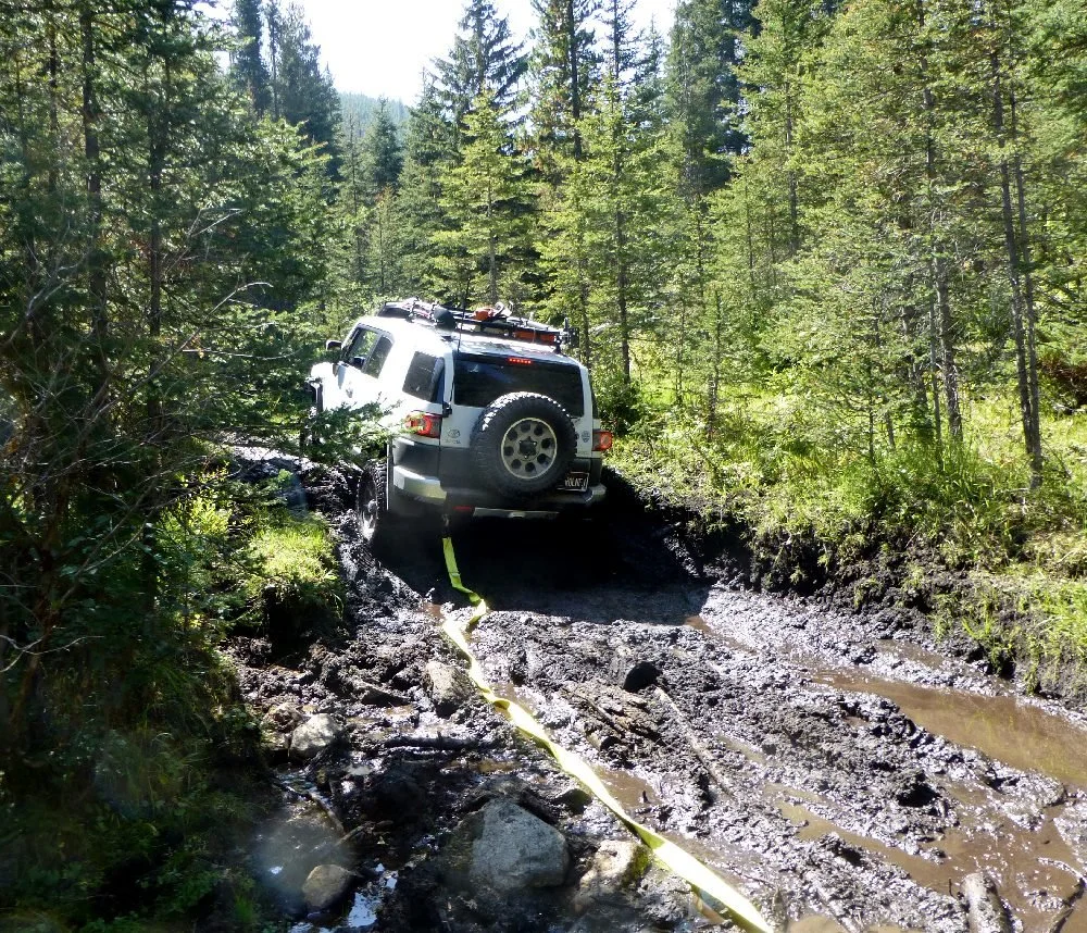
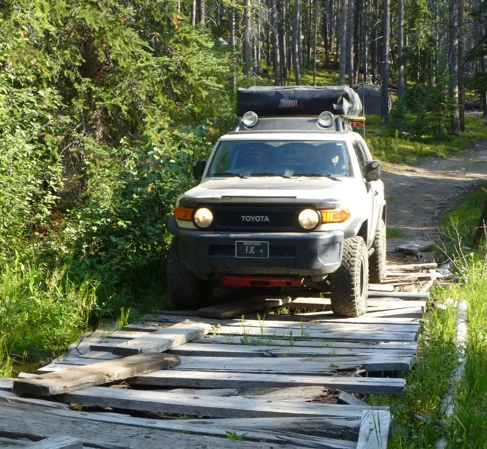
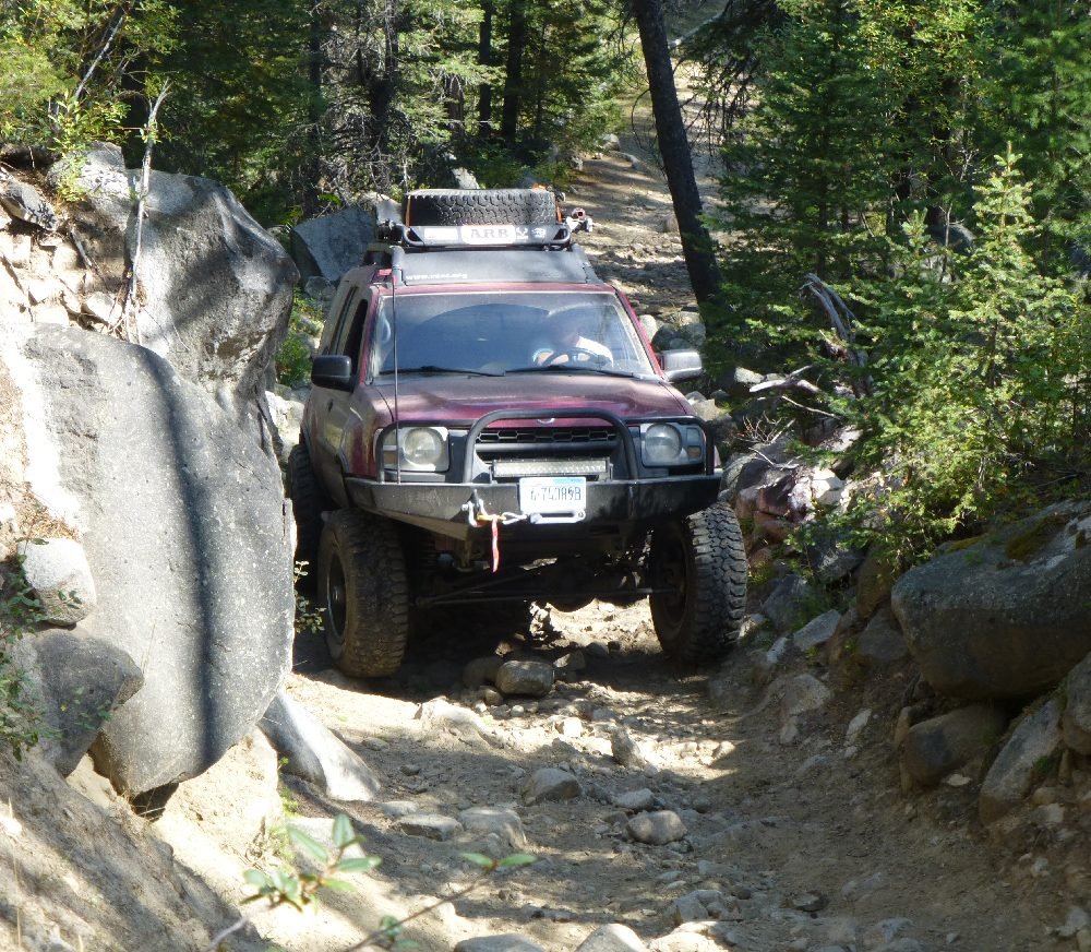
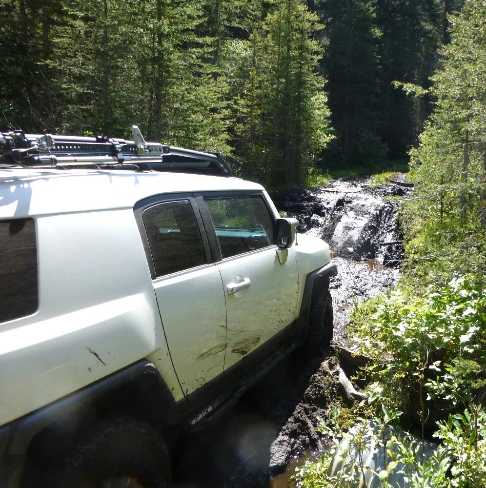
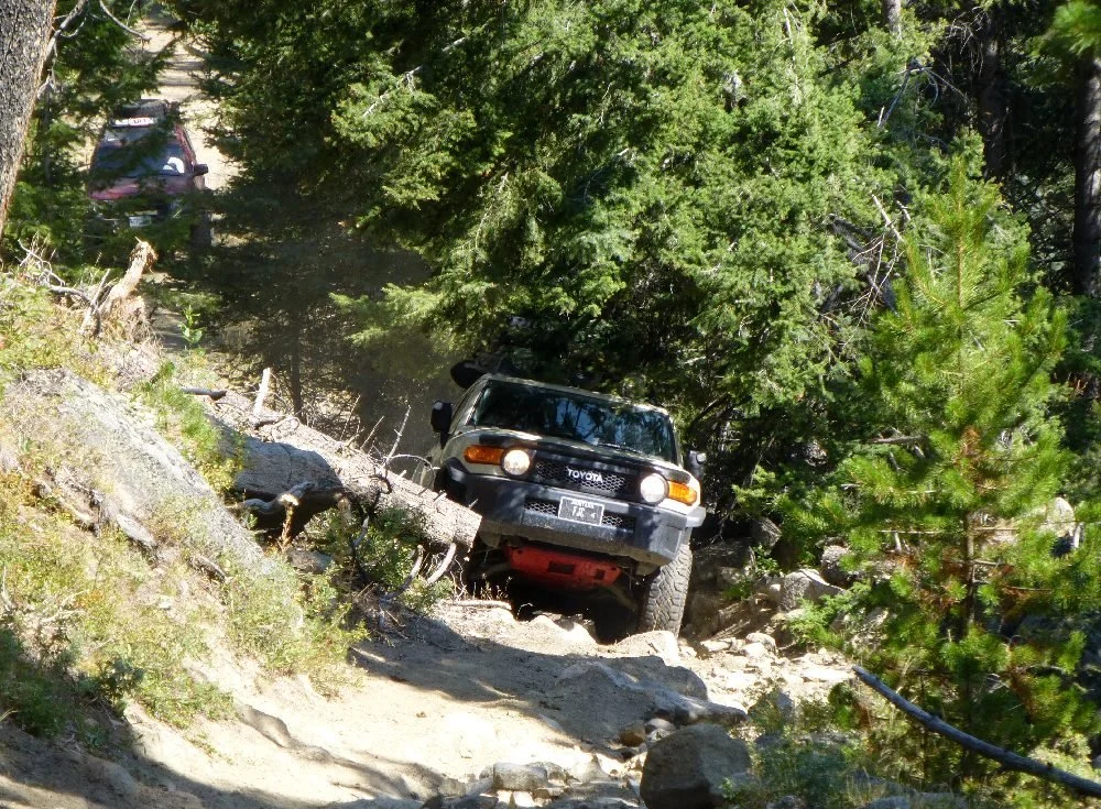
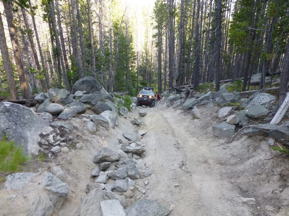
Photos: Aaron Thies / AGF, Aug. 26, 2017. They show the route on that trip, not current conditions.
Sources & Review
- USFS EDW RoadBasic: NFSR 86 Little Boulder (queried Oct. 9, 2026) (FS jurisdiction MP 2.45–11.8; ML3 "Suitable for passenger cars"; open for use to all; Butte RD)
- USFS EDW RoadBasic envelope queries (no FS Road 8675; only FSR 86 near the turnaround)
- USFS EDW Basic Ownership (turnaround non-FS; track start outside the forest)
- BLM National SMA (limited scale) (turnaround private; private land toward Boulder)
- Census TIGERweb local roads (Little Boulder Rd as a local road; not a legal-status source)
- Beaverhead-Deerlodge Forest Plan, Boulder River Landscape (Little Boulder MA: "Big game winter range is closed to motorized activities in winter")
- Beaverhead-Deerlodge NF: Travel management maps (wheeled MVUMs online only for the Gravelly and Tobacco Root ranges)
- Beaverhead-Deerlodge NF alerts (checked Oct. 14, 2026; no Little Boulder alert; food storage order)
- Beaverhead-Deerlodge NF: Offices (Butte RD 406-494-2147)
- Jefferson County Road & Bridge Supervisor (Bear Taylor), email to AGF, Oct. 13, 2026 (3:05 pm) (official, written; the obstacle is before the Shiels and Ironside mine; modified rig with 33-inch tires minimum and at least one locker; body damage with less)
- MVUM roads, 2023 copy of the FS S_USA.Road_MVUM layer (official data (2023 copy, non-FS host); read Oct. 13, 2026; FS 86 LITTLE BOULDER MP 2.85–12.2 "Special Designation, Yearlong" (ATV and motorcycle open; >50-in. OHV blank); Butte RD; 2026 MVUM: verify)
- Jefferson County Road & Bridge Supervisor (Bear Taylor), email to AGF, Oct. 13, 2026 (official, written; Little Boulder Rd county road in its entirety (~9.9 mi from Whitetail Rd); no seasonal restrictions; steep large-boulder climb at about mile 9)
- Jefferson County Road Department ((406) 225-4158; no road list online)
- USGS: Little Boulder River above North Fork (gauge location on the route)
- onX Offroad: Little Boulder River Rd (third party; rated 3; body-damage warning; Aug. 19, 2023 "Temporarily Closed" report)
- Montana FWP: Hunting seasons (2026 deer/elk archery Sept. 5–Oct. 18; youth deer Oct. 15–16; general Oct. 24–Nov. 29)
Last reviewed Oct. 14, 2026. Jefferson County confirmed Little Boulder Rd is a county road with no county seasonal restriction. Its steep boulder climb before the Shiels and Ironside Mine area takes a modified rig with at least 33-inch tires and one locker (county), which sets the owner's 6/10 (Oct. 14, 2026); the rest of the road is about 3/10. The upper end is a private inholding, the climb's location and the winter-range closure need verifying, and AGF ran this route on Aug. 26, 2017.
AGF ratings describe normal, dry-condition difficulty. They do not mean a route is legal, open or passable today. Spot something out of date? Use the Contact page.